'Lives on the Ground' - A. Hoffman

Adina Hoffman, in a book review running now in the Nation, talks about "the true Jerusalem syndrome, familiar from those medieval maps that turned the town into the omphalos, the hub around which the rest of creation revolves. Libraries loom large in this cramped cityscape--so much so that Oz announces at one point, "When I was little, my ambition was to grow up to be a book."
Hoffman's takes on the regional writers Amos Oz, Sari Nusseibeh, Raja Shehadeh, David Shulman are savvy and well-written. And she also got me perusing medieval maps
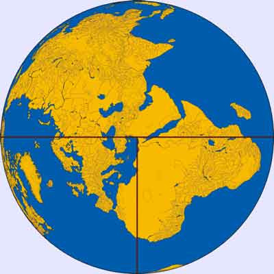
The map below is modern cartography inspired by Beatus of Liébana, an 8th century Spanish monk. A map with Jerusalem at the center appeared in the prologue to his twelve books of commentaries on the Apocalypse, similar to the one above.
It purports to show the inhabited world of the northern land mass -- the three continents of Africa, Asia and Europe. The navel of the world, umbelicus mundi, always is at Jerusalem. Asia was typically the size of the other two continents combined. The land on the map is divided into three parts by a "T" shape in which Asia occupies the top of the T area, Europe the bottom left and Africa the bottom right, within the "O" of the Ocean surrounding and separating them. Thus, North is to the left and South is to the right.
The T and O style of map is sometimes called a Beatine map, for Beatus.


No comments:
Post a Comment